The skies over Ottawa are about to open up in a significant way, with Environment Canada warning residents to prepare for a substantial rainfall event that could bring between 30 to 50 millimetres of precipitation over the next two days.
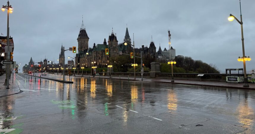
As I drove through downtown yesterday afternoon, the unusually dark clouds gathering over Parliament Hill seemed to signal the changing weather pattern we’re now facing. This system, which began developing west of the region, is expected to bring persistent rainfall that could impact everything from morning commutes to outdoor weekend plans.
“We’re looking at a slow-moving low pressure system that will affect much of Eastern Ontario,” explains David Phillips, Environment Canada’s senior climatologist. “Ottawa residents should prepare for steady rainfall beginning late tonight and continuing through most of Thursday.”
The most intense precipitation is predicted to occur Thursday morning, potentially creating challenging conditions for the morning commute. Ottawa’s transportation department has indicated they’re monitoring storm drains in flood-prone areas, particularly around the Rideau Canal and low-lying neighborhoods near the Ottawa River.
This weather event follows what has been an unusually dry late summer for our region. The Ottawa International Airport weather station has recorded approximately 35% less precipitation than normal over the past month. While the incoming rainfall might inconvenience many residents, local agricultural experts note it could benefit farmers who have been dealing with increasingly dry conditions.
“This rain is actually coming at a good time for many crops,” says Jennifer Robertson, agricultural specialist with the Ontario Ministry of Agriculture. “While too much at once can always create issues, the soil moisture levels could use replenishing before harvest season begins in earnest.”
City officials are recommending residents take standard precautions, including clearing nearby storm drains of debris and securing outdoor items that might be affected by wind and rain. Those living in areas historically prone to basement flooding should be particularly vigilant.
The Ottawa River Regulation Planning Board indicates current water levels remain well below flood stage, with sufficient capacity to handle the anticipated rainfall without significant concerns for waterfront properties. However, they’ll continue monitoring conditions as the rain develops.
For parents with young children, the timing creates challenges with back-to-school schedules. The Ottawa-Carleton District School Board has issued guidance to parents, noting that outdoor recess activities may be limited during periods of heavy rainfall, but schools will otherwise operate on normal schedules.
Local weather patterns have become increasingly variable in recent years, a trend many climatologists attribute to broader climate change impacts. Phillips notes that while this rainfall amount isn’t unprecedented, the intensity of precipitation events has been trending upward across Eastern Ontario.
“What we’re seeing more frequently is not necessarily more total rainfall annually, but more of it coming in concentrated bursts,” Phillips explains. “These types of systems that park over a region for extended periods are becoming more common.”
As someone who’s covered Ottawa weather events for over a decade, I’ve noticed how quickly conditions can shift from drought concerns to flood watches. Just last year, a similar September rainfall created temporary flash flooding along parts of Bank Street and the Glebe, catching many businesses unprepared.
Residents should also note that Environment Canada predicts clearing conditions by late Friday, with sunshine potentially returning for the weekend—welcome news for the numerous community events scheduled across the city.
For now, it might be wise to keep umbrellas handy and perhaps reschedule any outdoor plans for Thursday. Most importantly, drivers should exercise additional caution during periods of heavy rainfall, particularly on the Queensway and other major thoroughfares where visibility can be significantly reduced.
The City of Ottawa’s 311 service remains the best contact point for reporting localized flooding or infrastructure concerns related to the rainfall. Emergency services have additional crews on standby, though they anticipate a manageable response to this weather event.
After covering numerous weather systems affecting our region, one thing remains certain—Ottawa residents are nothing if not adaptable to our ever-changing climate conditions. As we prepare for this latest rainfall, perhaps we can take comfort in knowing that