The skies over Ottawa are turning increasingly gloomy this evening as forecasters warn of significant rainfall heading our way. Environment Canada is projecting between 15 and 25 millimetres of precipitation to soak our region through Wednesday, with the heaviest downpours expected overnight and into tomorrow morning.
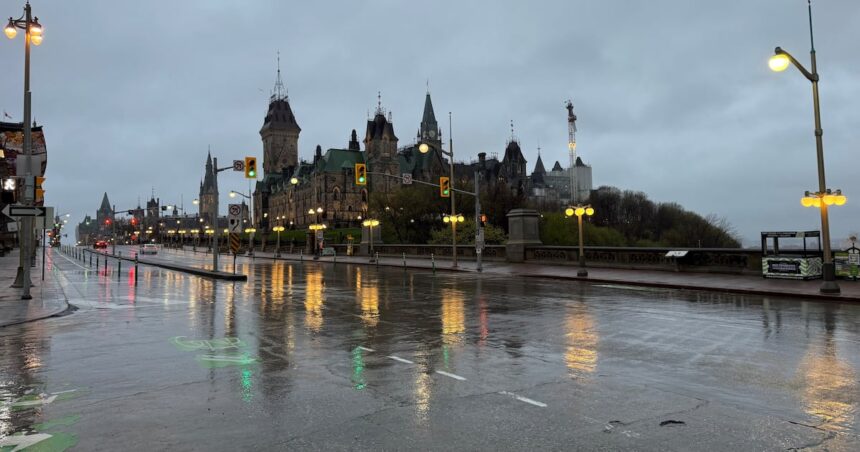
I was outside Parliament Hill earlier today when those first scattered drops began falling. The suddenly quickened pace of pedestrians seeking shelter told the story before the weather radar could confirm it – Ottawa residents recognize the signs of incoming weather systems all too well.
“We’re looking at a fairly substantial rain event developing over the next 24 hours,” explains David Phillips, senior climatologist with Environment Canada. “This system is drawing significant moisture from the south, creating conditions for sustained rainfall across the capital region.”
The timing couldn’t be more problematic for commuters. The heaviest rainfall is expected to hit during Wednesday morning’s rush hour, potentially creating hazardous driving conditions and delays throughout the city’s transportation network.
Ottawa’s water management officials are closely monitoring the situation. After several dry weeks, the ground can initially absorb some precipitation, but the volume expected could quickly lead to localized flooding in low-lying areas.
“Our storm management systems are prepared, but residents should take precautions if they live in areas prone to water accumulation,” advises Carol Anne Meehan, Ottawa city councillor. “Clearing nearby storm drains of autumn leaves can make a significant difference in preventing localized flooding.”
For context, Ottawa typically receives about 86 millimetres of rain during an average October. This single system could deliver nearly a third of that monthly total in just 24 hours.
The rainfall warning comes as many local farmers were hoping for a few more dry days to complete their harvests. The Ottawa Valley agricultural community has reported varying conditions this season, with some crops benefiting from earlier rainfall patterns while others struggled.
“This much rain at once isn’t ideal timing for those still bringing in crops,” notes Bruce Henbest from the Ottawa Valley Agricultural Association. “Many producers have been working extended hours this week, anticipating this weather system.”
City residents planning outdoor activities should prepare accordingly. The rain is expected to taper off by late Wednesday afternoon, though scattered showers may persist into Thursday morning according to the latest Environment Canada projections.
For those who rely on public transit, OC Transpo has issued advisories about potential delays on certain routes, particularly those in areas historically susceptible to water accumulation. Patience will be essential during tomorrow’s commute.
Walking through the Byward Market this afternoon, I noticed vendors preparing for the downpour, securing display materials and adjusting their setups. It’s part of the rhythm of Ottawa life – adapting to our sometimes challenging weather patterns while carrying on with daily business.
As evening settled over the capital region, the previously scattered raindrops have grown more persistent. Weather radar shows the main system approaching from the southwest, bringing the heaviest bands of precipitation overnight.
For residents concerned about property protection, the City of Ottawa recommends checking sump pumps, ensuring downspouts are directed away from foundations, and securing outdoor items that could be affected by wind gusts accompanying the rainfall.
The silver lining? Temperatures remain relatively mild for mid-October, with overnight lows staying above 10 degrees Celsius and daytime highs reaching the mid-teens. No risk of freezing precipitation accompanies this system.
As we move deeper into autumn, these rainfall events become increasingly significant. With leaf fall accelerating, storm drains can quickly become clogged, making neighborhood-level vigilance important during heavy precipitation.
Ottawa’s emergency services remain on standard alert status, with no special measures implemented yet, though this could change if rainfall exceeds